The Forgotten Battle on Sullivan’s Island: The Sand and Marsh That Saved American Independence
#மறைக்கப்பட்ட வரலாறு#அமெரிக்க புரட்சி#சல்லிவன் தீவு#1776#ஃபோர்ட் மௌல்ட்ரி#நாசா#லேண்ட்சாட் 9#பனை மரம்#தென் கரோலினா#தாமஸ் ஜெபர்சன்#சுதந்திரப் பிரகடனம்#அமெரிக்க சுதந்திரப் போர்
மொழி:
🔊
இந்தக் கட்டுரையைக் கேளுங்கள்
🤖 AI மொழிபெயர்ப்பு — மனித ஆசிரியரால் மதிப்பாய்வு செய்யப்பட்டது · AI translation, human-reviewed
The Battle of Sullivan’s Island: How Sand and Marsh Won a Key American Revolutionary Victory
On June 28, 1776, while Thomas Jefferson and the Committee of Five in Philadelphia were presenting the first draft of the Declaration of Independence, British warships and thousands of troops were advancing toward Sullivan’s Island at the entrance to Charleston Harbor in South Carolina.
The fierce battle fought that day became a crucial turning point in the early phase of the American Revolutionary War. Largely inexperienced colonial forces decisively defeated the British. This victory not only saved the city of Charleston from occupation, but also greatly boosted American morale at a critical moment in the war.
Sullivan’s Island from a Satellite View 250 Years Later
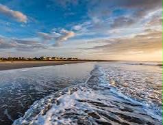
In an image recorded on June 3, 2026 by NASA’s Landsat 9 satellite, the physical geography of Sullivan’s Island remains largely unchanged. Although 250 years ago there were no roads or modern buildings, these sandy beaches, salt marshes, and the island’s overall shape would have looked much the same.
Fort Moultrie: A Palmetto-Log Bastion
At the island’s southern tip, guarding the harbor entrance, stood Fort Sullivan, built from palmetto logs. Constructed largely by enslaved people, the fort was not fully completed when the battle took place. Even so, it had sand-filled walls 16 feet thick and mounted 31 cannon.
When British warships fired thousands of cannonballs, the palmetto’s natural strength and flexibility absorbed them “like sponges,” wrote the fort’s commander, Colonel William Moultrie, in his memoirs. The marshy ground at the fort’s center immediately swallowed shells that landed there. Cannonballs that struck the sand buried themselves, and most did not explode.
Victory Shaped by Geography
To the north of the island, the British planned to cross on foot via Breach Inlet. They believed that at low tide the water would be only 18 inches deep. In reality, it was more than 7 feet deep. As a result, they could attack only in small groups using flatboats. The 800 colonial soldiers and Catawba warriors entrenched behind earthen works easily drove them back.
At sea, the colonists concentrated their limited ammunition on the ship of British commander Sir Peter Parker. The vessel was heavily damaged and 40 men were killed. After ten hours of fighting, the British forces withdrew.
“We have never suffered such a crushing defeat in our lives,” one Royal Navy sailor noted.
An Enduring Symbol in History
After the battle, Fort Sullivan was renamed “Fort Moultrie.” The palmetto tree, which became a symbol of colonial resistance, still appears on the seal of the state of South Carolina today. Six days after this victory, on July 4, 1776, the Declaration of Independence was adopted in Philadelphia.
Image credit: NASA Earth Observatory / Landsat 9
Historical sources: U.S. National Park Service; South Carolina historical records
Give suitable titles for uploading this in separate parts.gallery


உங்கள் படைப்பைச் சமர்ப்பியுங்கள்
கவிதை, கட்டுரை, கண்டுபிடிப்பு, அனுபவங்களை அறிவுப்பசி மூலம் உலகறியச் செய்யுங்கள்.
Discussion (0)
Be the first to comment.
தொடர்புடைய கட்டுரைகள்


தொடர்புடைய கருவிகள்